Training
Flight systems can only be used effectively, if the pilot is trained in the flight system as well as data processing and evaluation. Therefore we offer various training courses for flight systems and software products.
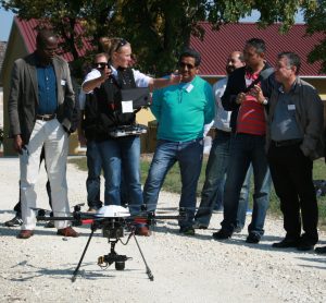 We offer you an individual three-day training for your employees (maximum of 3 people is best). All air law rules and flight theory principles as well as the practical introduction to the flight system are covered. The training also treats a large number of practical flight exercises for safe control of the aircraft and the necessary emergency situations. In addition, an introduction to the relevant software packages (such as e.g. the photogrammetry software Agisoft Photoscan) is given. Hence you are ready to execute your own missions directly after our training.
— Customer-specific training at the desired time, no fixed date for several customers together
— Huge training ground for missions of various scenarios
— Flight practice and software introduction
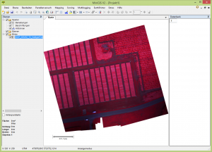 We offer you an individual training at Adelschlag or at your site to introduce you to the purchased modules of MiniGIS or CoGIS, such as flight planning, automatic scoring, creating application maps etc. All relevant steps in the software are presented live and can be done on your own PC. As training material, either demo-data from our large archive of a variety of crops or your own acquired data can be used.
— Individual training
— Training directly from the manufacturer of the software
— Training based on own data or archived demo-data
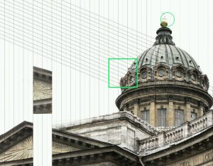 geo-konzept is one of few official AgiSoft training centers worldwide. We offer you one-day software training in AgiSoft Photoscan Professional/Standard at our office or at your site. The training gives you a comprehensive introduction to the handling of Photoscan and an introduction to the photogrammetric basics. Afterwards you are able to directly process your own projects. Of course, a support (via telephone, email, TeamViewer) is included in our service after the training, should any problem arise in the workflow.
The training is carried out accordingly to the customer’s need, so we can address your questions and wishes precisely. As training material either demo-data from our extensive archive of multiple applications (e.g. mining, agriculture, seed breeding, surveying, 3D object documentation etc.) or your own data can be used.
— Official AgiSoft training center with many years of experience
— Individual training adapted to your applications
— Training based on own or demo-data of many different applications
— Training in a pleasant, calm and modern atmosphere


