In remote sensing, multispectral cameras have become an indispensable tool for aerial vegetation analysis. This additional information provides farmers and researchers with valuable insights into the health of crops and plants.
For many years, geo-konzept has successfully collaborated with high-quality partners in the field of multispectral data acquisition, some of whom have been pioneers in this area for decades, offering superior image quality, robustness, flexibility, and innovation. The cameras are deployed on a variety of aircraft systems.
DJI Mavic 3M
The flying helper for agriculture & research
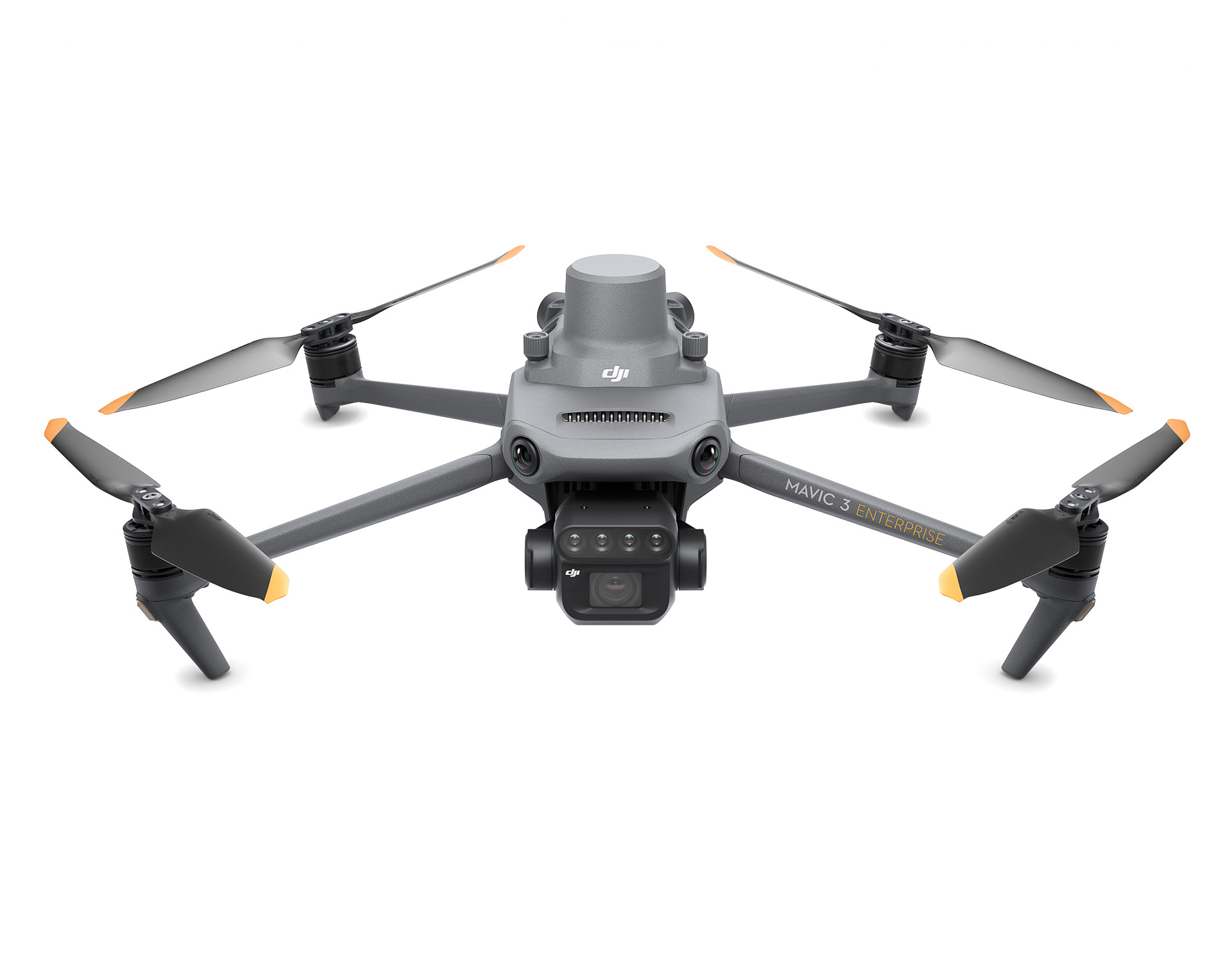
Features
— Multispectral: 4 × 5 MP (G/R/RE/NIR)
— RGB: 20 MP
— Up to 200 acres per flight
— 43 min. flight time
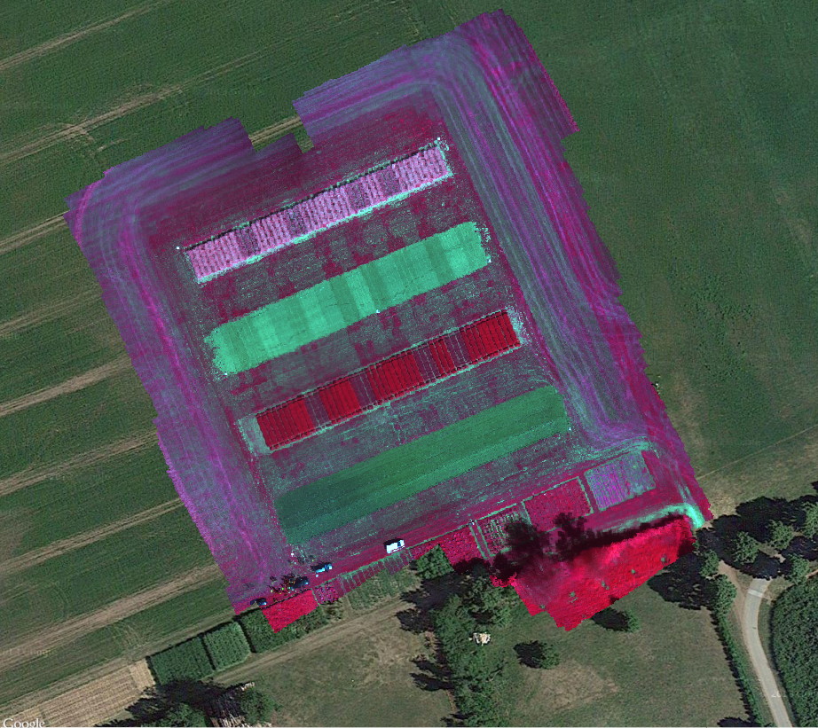
Effective aerial surveying requires noticing the invisible. That’s why the Mavic 3 Multispectral features multiple cameras, providing you with a variety of perspectives. It combines an RGB camera with a multispectral camera to scan and analyze plant growth with absolute precision. Precision agriculture and research demand relevant details and data – the Mavic 3M delivers both.
The integrated sunlight sensor captures solar radiation and records it in an image file, enabling light compensation of image data during 2D reconstruction. This results in more accurate NDVI results and improved accuracy and consistency of data collected over time.
The RTK module ensures centimeter-level positioning: The flight controller, camera, and RTK module are synchronized in microseconds to precisely determine the center position of each camera shot. This allows the Mavic 3M to perform highly accurate aerial surveying without the need for ground control points.
MicaSense Altum-PT (Payload just for Trinity Pro)
RGB, multispectral und thermal imaging camera
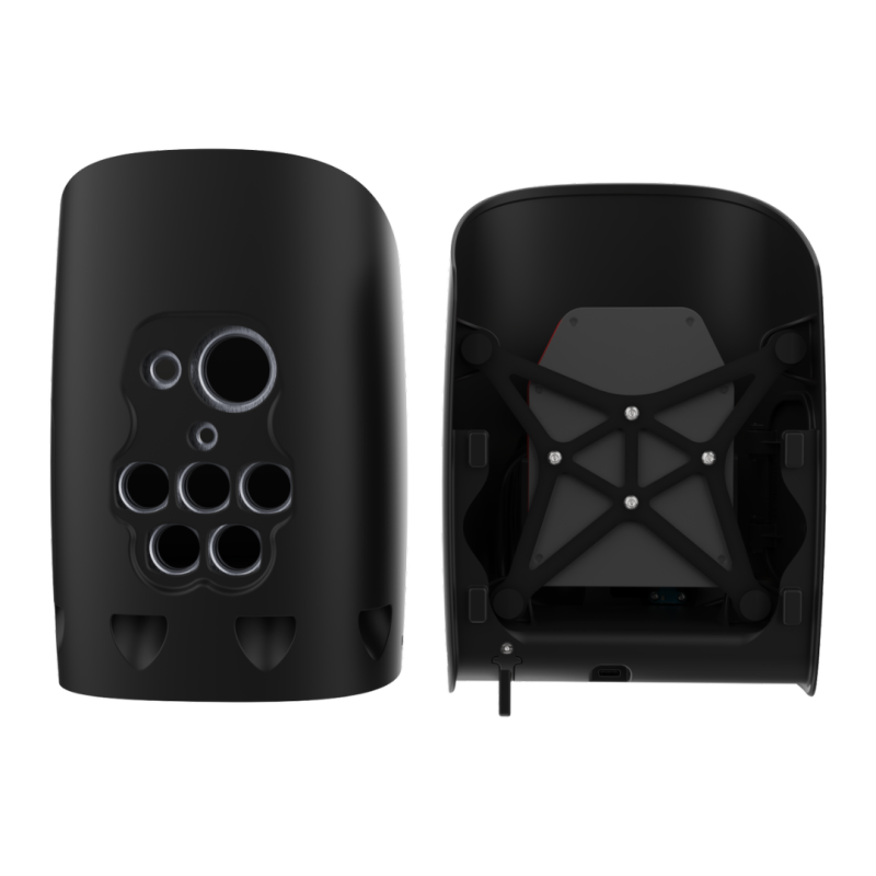
Features
— 3,2 MP (multisp.), 12 MP (PAN)
— RGB: 12.4 MP; Global Shutter
— 3 configurable GPI
— FoV up to 50° (hor.)
The MicaSense Altum-PT is a premium multispectral camera with synchronized thermal imaging, ideal for agricultural production, phenotyping, and environmental monitoring.
The camera captures synchronized multispectral, thermal, and panchromatic data for pixel-accurate, high-resolution output for advanced applications in vegetation research. These include monitoring plant health from early emergence, including thermal data for assessing water stress and monitoring irrigation systems.

