Precision Farming from the air!
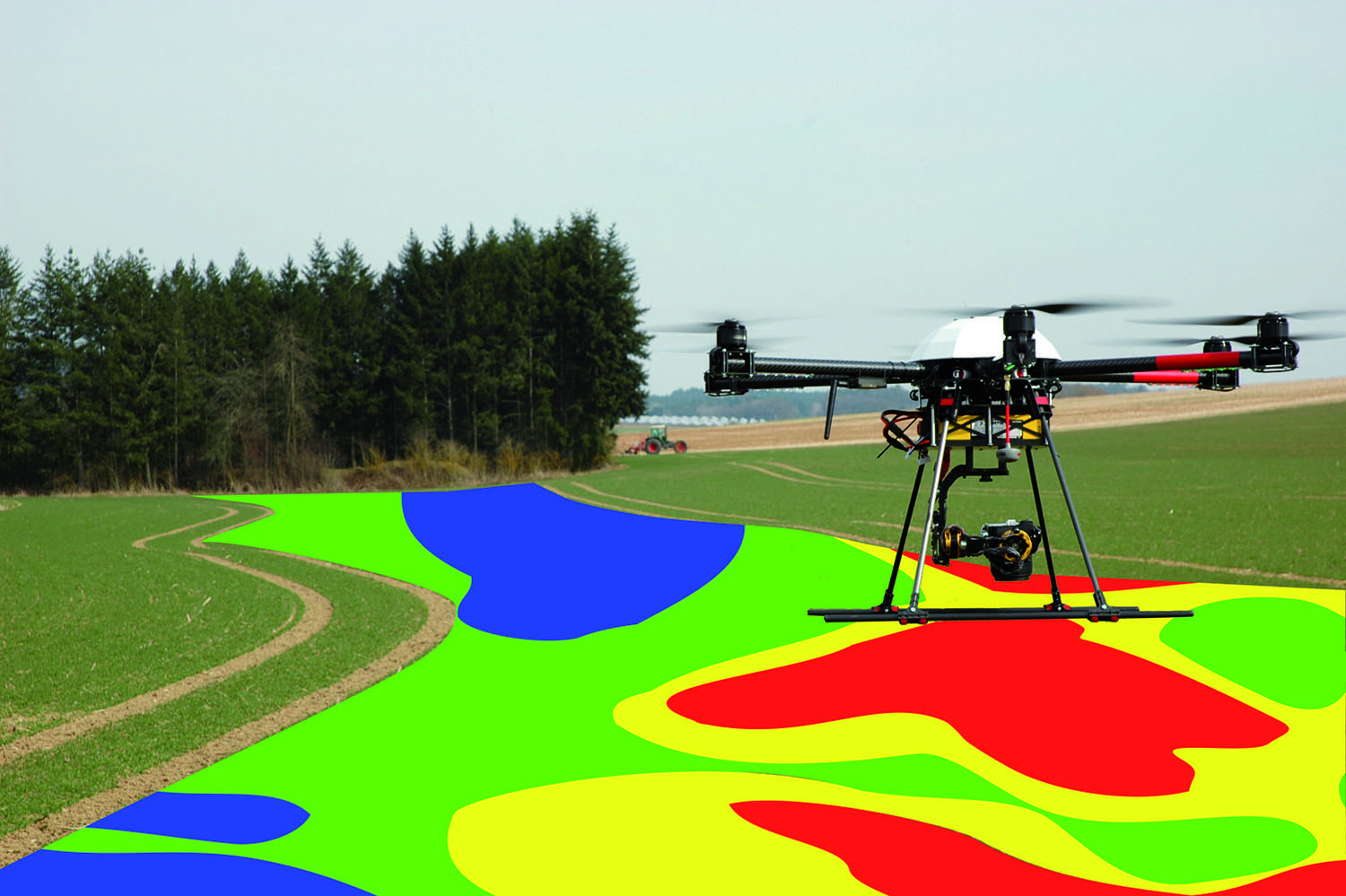
 The Trinity multispectral bundle, combined with the software CoGIS, is an ideal tool for a huge amount of precision farming applications. CoGIS is used to immediately evaluate the generated data. Any vegetation index can be calculated and quickly and easily converted into zone and application maps. These can be directly transferred to the automatic steering system of the tractor, thus ensuring a site-specific application of seed rate, fertilizer etc.
This bundle also is an ideal tool for targeted weed control. Especially during the maturation phase, weed clusters can be detected very precisely from the air, mapped and subsequently treated from the ground. As the grain already matured, the weed often shows a bright green colour. This approach bears great potential, especially with regard to the economical, environmental friendly site-specific soil treatment or application of herbicides that will get an increasingly important role in the future due to state regulations.
Your advantages
— Objective procedure
— Up-to-date application maps can be created
— Quick and easy zoning even of large fields is possible
— Data acquisition and processing is carried out directly on your farm
— No need to load the collected data into a cloud for processing
— Possibility of archiving and comparing over several years
— Hard- and software solution by a well-known Precision Farming specialist
— No running costs


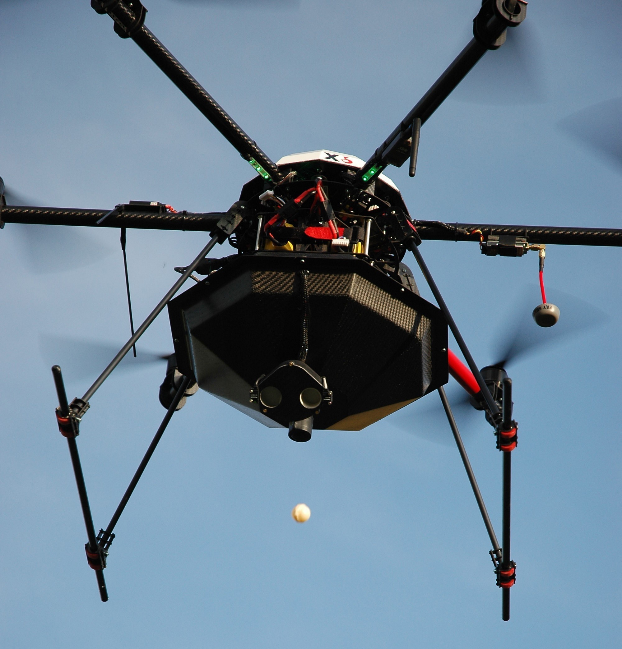
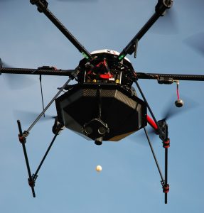 Our copter, together with the customised Trichogramma dropper, offers farmers and service providers the ideal tool for a quick, efficient and cheap biological pest control in corn. The dropping of each single bullet is monitored and registered for an exact control over the treatment. Thus even huge fields can be treated in only a few minutes. As more and more federal states in Germany offer financial promotion for treating corn borer with Trichogramma, the farmer only has low costs with this method.
 With our UAV solutions it is possible to execute precise and high-resolution forestry surveys. On the one hand, automatic height measurements of trees or type classifications can be done. On the other hand, it is possible to detect diseases and pests as soon as possible with multispectral images. Furthermore in combination with our software
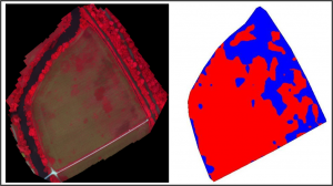
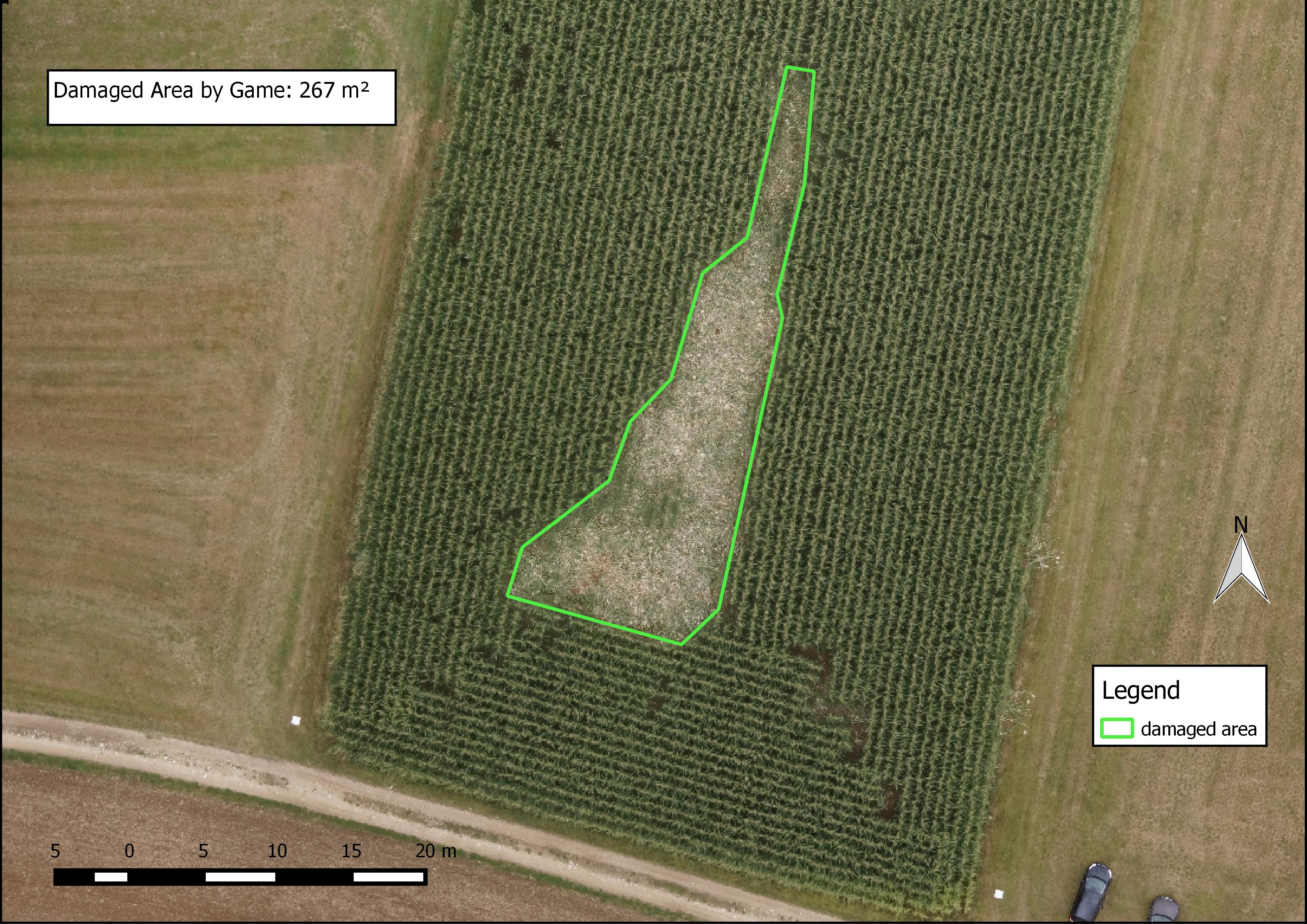
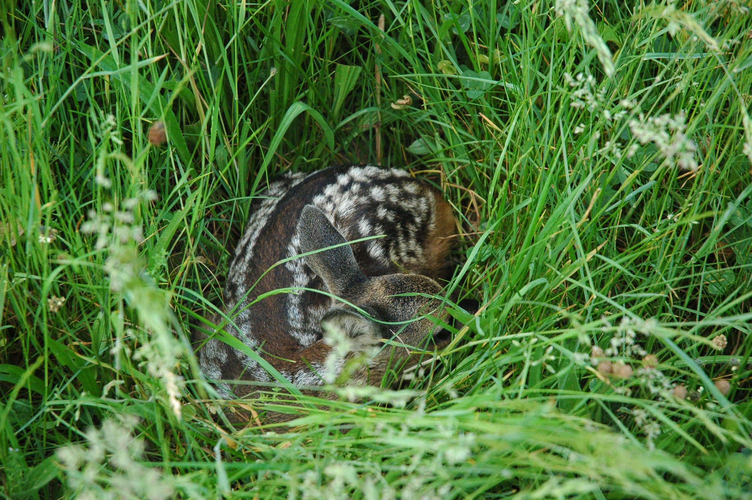
 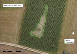 It is often difficult to detect the extent of animal or hail damage in the crop from the ground. Our UAVs can be used to quickly create georeferenced aerial photographs that do not only visualize damage to the crop, but also make it quantifiable. In the generated orthophoto, the damaged areas (e.g. by hail or game animals) can be digitized and, if necessary, divided into zones. To check these areas, the aerial image can be transferred to a GPS-ready tablet and the damage can be found quickly and easily in the terrain with the help of the software CoGIS.
 Combined with the in-house software
