CoGIS flight planning
 For agricultural service providers, CoGIS offers a range of functions for surveying, soil sampling and remote sensing.
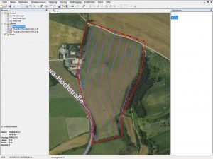
CoGIS UAV module enables the automation of flight planning for the creation of application maps or documentation of damage caused by game animals. The flight planning for your agricultural fields can done quickly and easily either by means of existing field boundary files or based on a satellite background image at the office PC or outside in the field. You can freely select all relevant flight parameters such as flight direction, overlap, altitude and speed. Or you can define standard flights for specific often needed scenarios in our useful flight profiles. In this case the software automatically suggests the appropriate parameters for you. For very large flight areas, an automatic splitting of a flight into several missions is possible within one mouse click. Afterwards the CoGIS flight plan can be directly transferred to the XR6 Hexacopter via Bluetooth or USB cable.
Performance features
— Simple and intuitive flight planning
— Control of all relevant flight parameters
— Planning via predefined flight profiles possible
— Planning directly based on field boundaries possible
Data sheet


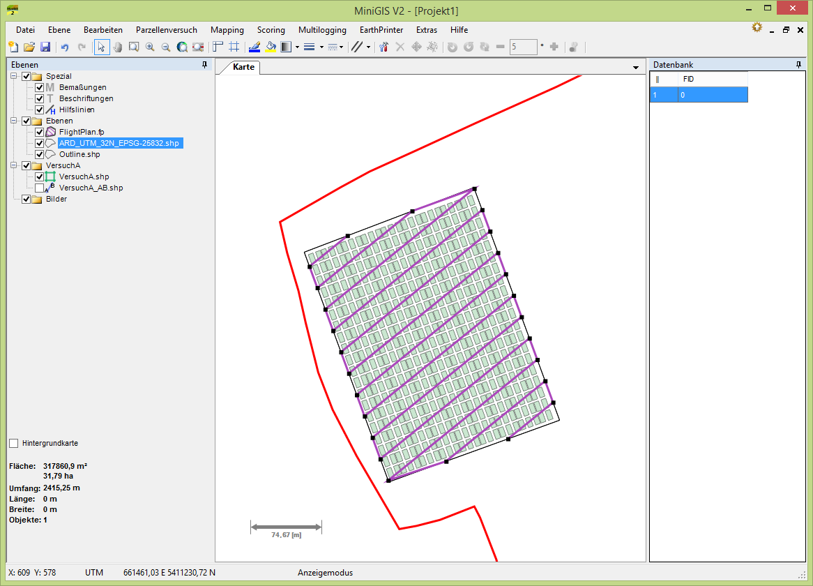
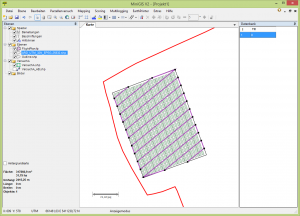 The flight planning for your parcel trials can be done easily and quickly by using existing MiniGIS plans on the office PC or outside in the field. You can select all relevant flight parameters like flight direction, overlap, altitude and speed. Or you can define standard flights for often needed specific scoring scenarios in our useful flight profiles. So the software automatically suggests the appropriate parameters. In the case of very large flight areas, an automatic splitting of an area into several missions is possible within one mouse click. Afterwards the MiniGIS flight plan can be transferred directly to the XR6 Hexacopter via Bluetooth or USB cable.
