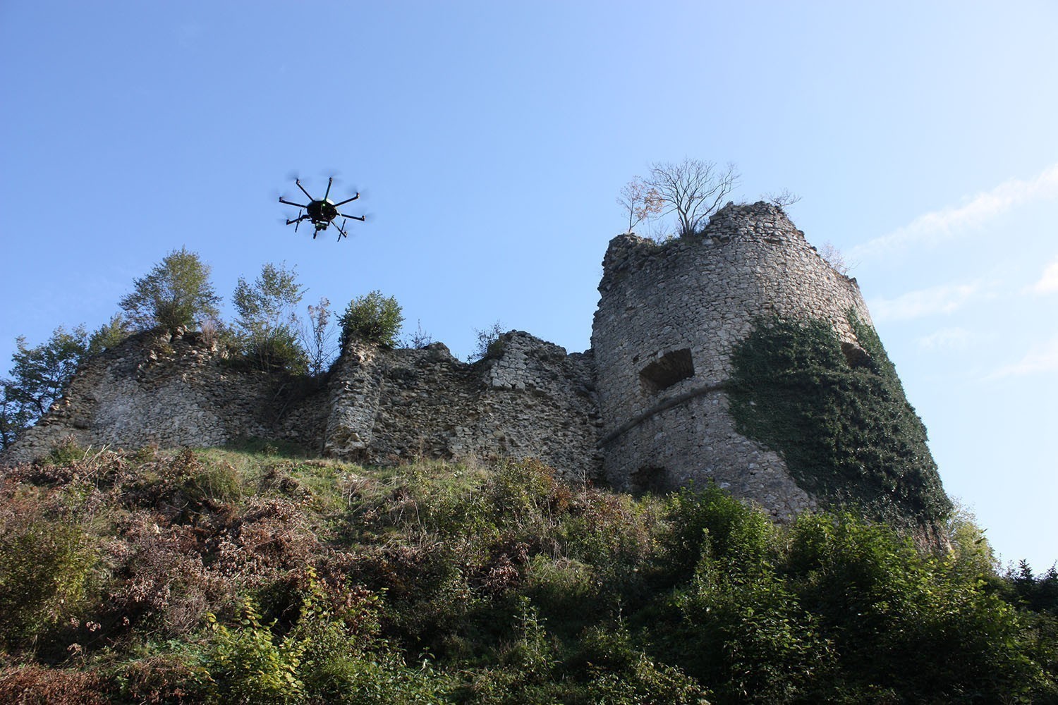
Documentation of archaeological excavations and aerial archeology
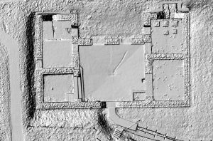 Archaeological excavations often have to be done under time pressure. By means of our flexible copter bundles, they can be documented easily and quickly. With only one flight, an excavation level can be recorded and analyzed later in the office to create a digital feature plan. Furthermore you get an exact elevation model of the ancient floor level or of preserved upstanding walls.
Apart from the documentation of excavations, it is possible to detect archaeological features as crop marks in the fields by a multispectral camera. Hence aerial archaeology can be done in a considerably higher resolution than with a conventional airplane.
Your advantages
— Cost-effective, fast and easy documentation of an excavation floors (also with large route excavations)
— Equalization of work peaks, as feature maps can be drawn after the end of the excavation campaign in the office
— High-resolution aerial archeology can be carried out
— No running costs
Data sheet


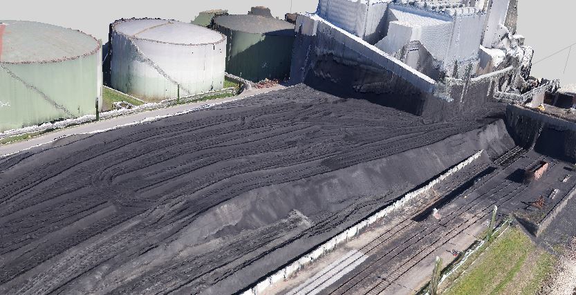
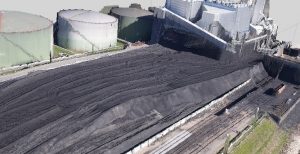 For instance huge coal power plants need an efficient operating sequence planning. For this purpose, geo-konzept’s UAV stock-pile survey system offers an excellent tool for operating companies and service providers, as it enables a quick (and hence cost-effective) survey of the coal deposits, so type, origin and quantity can be exactly mapped. Furthermore the calculation of the delivered coal quantities as well as the planning of the resources is simplified. With the help of a thermal camera, you can quickly and early recognize and combat glow nests in the stock-piles.
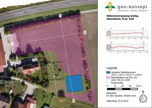 Our copter bundles with a high-resolution RGB-camera offer the possibility for a quick and cost efficient survey for construction work or documentation of existing structures. So e.g. retention plots for sealed areas in the area of flood protection can be determined. Based on height profiles it is also possible to detect the flow direction of the water with respect to the retention area. Furthermore a high-precision and high-detailed survey of small features like graveyards can be done easily and quickly.
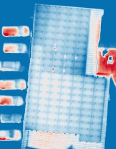 Together with a high-resolution thermal camera, our copters enable an inspection of photovoltaic plants, integrated onto roofs or solar parks. Broken solar panels show up as hotspots in thermal images with a significantly higher temperature compared with neighboring working panels. As a complete solar park can be mapped with only one flight, this is an efficient und hence economic method for inspecting such power plants.
