Remote Sensing for Field Trial Scoring
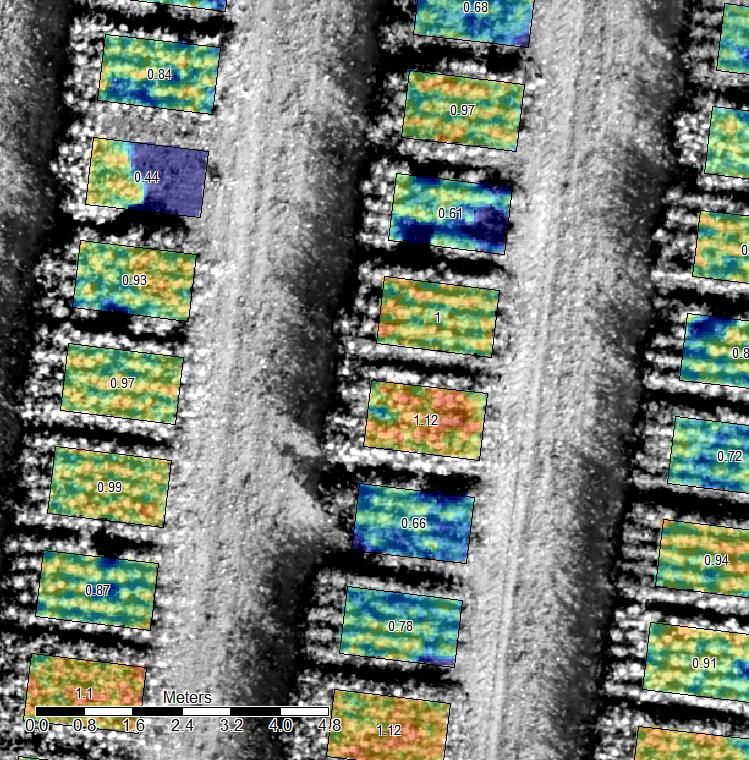
Our solutions are used in field trial management for automatic scoring of several different parameters of varying crops. By UAV these parameters can be documented easier, quicker and more objective than hitherto. The analysis of the different parcels can be done by high-resolution RGB-camera, multispectral camera or thermal camera. geo-konzept offers ready-to-use solutions for scoring of plant height, biomass and beginning of flowering. Multiple other features of the plants can be gathered semi-automatically. The most useful vegetation indices for your trial problem can be used and implemented. geo-konzept’s UAV solutions and software for trial planning and evaluation will be more and more linked together and permanently refined.


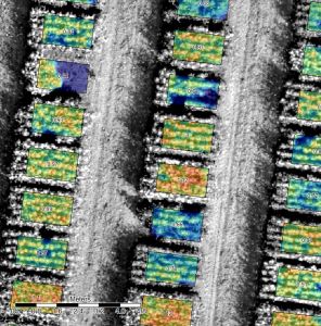 The crop height can be exactly determined from the air. Via photogrammetry, high-precise 3D models of plant populations can be created. As a result between 5,000 and 25,000 height values per parcel are displayed. Furthermore estimations on the parcel homogeneity can be gathered. By multiple flights, temporal developments can be displayed. The growth behaviour of breeds are shown spatially and temporarily with a high precision. Through the comparison of plant height after lodging with a flight executed before, it is possible to measure the amount of lodging objectively for the first time. The lodging area per parcel can be assessed as well as the severity of lodging.
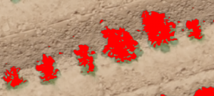 The counting of objects is one of the most personnel and time consuming scoring parameters in trial management. Via an UAV flight, RGB orthophotos with a high resolution can be created. Hence it is possible to count objects like e.g. single plants or spikes or flowers. With the Counting-AddOn for
  This
This 
