With geo-konzept you have exactly the right contact if you are interested in a drone. As a brand-independent consultant, we can offer you the best system for your application and provide you with comprehensive advice. The product range extends to different UAVs, from quadrocopters for surveying projects to hexacopters for searching for fawns to vertical take-off fixed-wing aircraft.
Our UAV systems can of course be equipped with your own sensor or with a camera or sensor system offered by us. This means that you can, for example, carry out your own yield forecasts and vegetation checks.
Our most popular drones:
NEW: DJI Matrice 4T --- Thermal for fawn search / inspection / security
Modern thermal drone with AI detection
The DJI Matrice 4T is suitable for emergency services, energy management, and, of course, fawn searches. The infrared thermal imaging camera offers a high-resolution mode with up to 1280 x 1024 pixels, and an additional NIR light can illuminate distances of up to 100 meters.
NEW: DJI Matrice 4E --- Surveying / Volume Determination / Documentation & Inspection
The surveying flagship with AI detection and laser rangefinder
The Matrice 4E is designed for applications such as surveying, mapping, construction, and mining. The 24 mm wide-angle lens with a mechanical shutter ensures the necessary sharpness even at high flight speeds and supports 0.5-second interval shooting. Smart 3D Capture lets you create rough point clouds right on the remote controller.
DJI Mavic 3T (C1) --- Thermal for fawn search / inspection / security
Compact & efficient: with thermal and RGB camera
Equipped with a thermal camera and a zoomable RGB camera, the DJI Mavic 3T is the ideal tool for searching for fawns. It is also perfect for inspection tasks, for example in PV systems and in wildlife monitoring.
Now with C1 drone class (EU)
- With the battery (EU C1 version) (4,230 mAh / 65.15 Wh / 285 g) and the quiet propellers of the DJI Mavic 3 Enterprise series, the maximum takeoff weight of the DJI Mavic 3T is only 899 g.
- Only the small drone license A1/A3 is required.
- Flying in the OPEN A1 category (close to people) is possible.
DJI Mavic 3E (C1) --- Surveying / Volume Determination / Documentation & Inspection
Wide angle & mechanical shutter: sharper ain’t possible
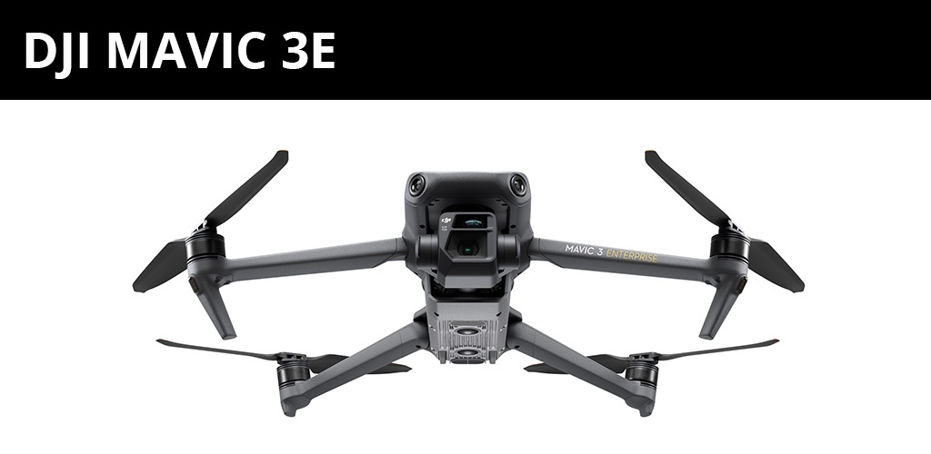
A drone designed primarily for surveying flights. The 20 megapixel RGB camera enables construction site documentation, volume recording and power line inspection.
Now with C1 drone class (EU)
- With the battery (EU C1 version) (4,230 mAh / 65.15 Wh / 285 g) and the quiet propellers of the DJI Mavic 3 Enterprise series, the maximum takeoff weight of the DJI Mavic 3E is only 899 g.
- Only the small drone license A1/A3 is required.
- Flying in the OPEN A1 category (close to people) is possible.
DJI Mavic 3M --- Multispectral for Agriculture / Biomass / Inspection
The flying helper for agriculture
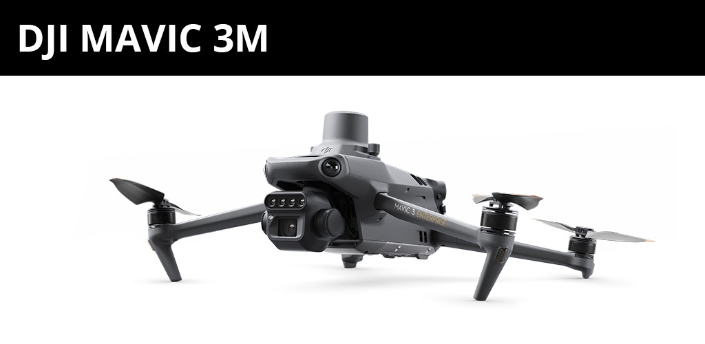
The drone for agriculture: Biomass differences can be documented using a multispectral camera, e.g. as a basis for application maps. The RGB camera enables, among other things, surveying, point cloud creation or silo volume determination.
NEW: DJI Matrice 400 RTK --- Testing / Research / Inspection
The flexible professional: highly intelligent, highly efficient!
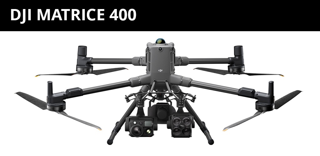
The new flagship enterprise drone platform: It boasts an impressive 59-minute flight time, a payload capacity of up to 6 kg, and integrated rotating LiDAR and mmWave radar for detection levels down to high-voltage lines. Combining intelligent detection with visual and thermal imaging, AR projection, ship-capable takeoff/landing, and advanced automation, the Matrice 400 excels in a wide range of tasks, from emergency response to power line inspection, mapping, and AEC.
Depending on the application, different requirements are placed on the aircraft. Does it have to be able to carry more weight because of a large sensor? Should the aircraft cover large areas or are you primarily concerned with the highest possible ground resolution? With our various systems, we cover a wide range of your requirements!
At geo-konzept, you not only get individual products, but we also see ourselves as a provider of complete system solutions. Your advantage: all hardware and software components come from a single source, are perfectly coordinated with one another and, thanks to our many years of know-how, are a perfect fit for your application. Let us advise you on which solution is best suited to your problem in agriculture, seed breeding or mining! We will put together your individual package for you.

