More software for mining applications
geo-konzept not only offers blast design software but also the digital mine planning software QuarryManager, the precise volume calculation tool VolumeX and ProAnalyst for analyzing high-speed camera images.
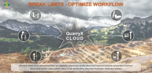 With the right systems, you can adapt your projects perfectly and optimize the blasting process. Our new cloud solution now also facilitates the workflow in the background – completely manufacturer-independent!
QuarryX Connect enables reliable automated data exchange between the various devices and machines and networks all stations involved in the blasting process – this form is unique in the world!
After scanning the rock face and setting the GPS reference points, the cloud does most of the work for you: the data obtained is synchronized and transferred in real time to the office, where the drilling rig is planned with QuarryX. The data required to mark the holes are then conveniently transferred to the mobile device – this means that different people can work on a project in parallel without having to use unnecessary transmission paths via USB stick or in printed form. Double savings: time and money!
If the RiGuide drill rig guidance system is installed, the drilling plan is synchronized directly with the control via the cloud! The portal also handles the writing back of the holes actually drilled and additional information conveniently, clearly and reliably.
An app specially developed by geo-konzept completes the service: this gives the drill operator all the important information about the location, direction, inclination and depth of the holes digitally at hand, even without a RiGuide, and can synchronize the drilling progress.
Planning, drilling, blasting and coordination are moving even closer together – you can optimize time and costs, too!
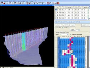
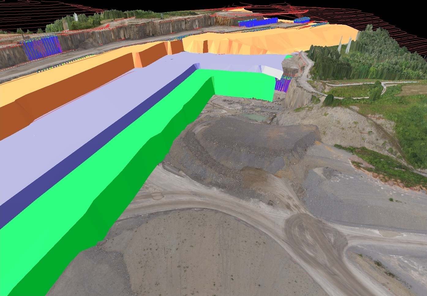
 QuarryManager is the right planning tool for you. Calculate mined volume, calculate mining reserves, create maps for employees or contractors quickly and easily. 3D mine planning with QuarryManager provides up-to-date and precise information, presented in a straightforward way, to help you make decisions.
QuarryManager is closely linked to geo-konzept’s blast design solutions. With it, you can easily import your QuarryX projects and your QuarryPocket GNSS data into the 3D quarry model. These data allow you to keep the mining plan up to date at all times. Additionally, QuarryManager offers a variety of interfaces for importing CAD or laser scanning data as well as data from UAV flights.
— Easy calculation of mined volumes and reserves
— Fast and simple maps for employees or contractors
— 3D mining plans updated daily
— Easily import QuarryX projects and QuarryPocket GNSS data into the 3D model
— Import geological models and flexible evaluation functions
 Trouble calculating masses and volumes? We have the solution!
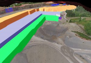
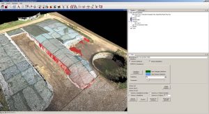
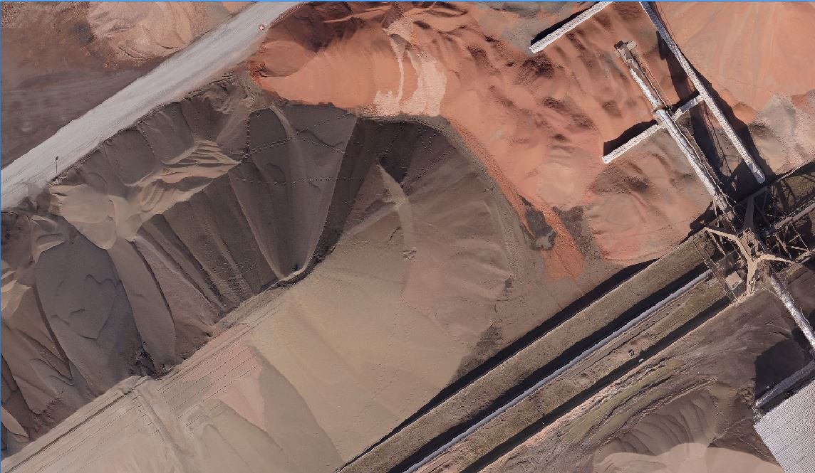
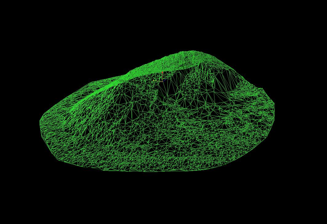
VolumeX enables high-precision volume calculation for dumps, heads and pits.
The special VolumeX software helps generate 3D models based on laser, UAV or GPS survey data. This enables high-precision volume calculations for dumps, heads and excavation pits, or even agricultural silos, in comparison to conventional methods.
— Volume calculations for dumps, heads, pits, silos
— Fast and objective digital inventory documentation
— Compatible with all geo-konzept GNSS, UAV and laser systems
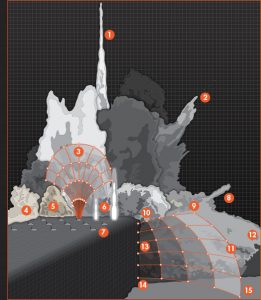 ProAnalyst is a software for analyzing high-speed camera images. Using different tools, for example, stone movement during blasting activities can be recorded and assessed.
The software enables import of almost any digital video to measure speed, position, size and acceleration of objects in the video. Analysis results can be displayed immediately as diagrams, thus allowing for fast and easy comparison with previous measurements. Furthermore, data can be exported in a variety of output formats.
— 2D images can be converted into 3D
— The software is compatible with almost all file formats
— Results can be shown immediately as diagrams


